D: The Suncoast / Tampa Bay
D: The Suncoast / Tampa Bay
Despite being a more populous region, paddlers can explore undeveloped islands and peninsulas and several unique historic sites and points of interest, such as Indian temple mounds. The dynamic Tampa Bay is a major feature. Rivers include the Hillsborough, Alafia, Little Manatee and Upper Manatee.
8: Pinellas/Hillsborough
This segment marks the beginning of a long stretch of urbanized coastline as you head south, but don't let that discourage you. You'll still be able to enjoy natural surroundings at several parks including three premier Florida state parks: Anclote Key, Honeymoon Island and Caladesi Island.
The extensive Pinellas County Blueways provides additional paddling opportunities and trip options along the coast. Plus, on the interior, the Hillsborough River offers a leafy canopy long enjoyed by paddlers.
The coastal portion of segment 8 starts at Anclote Key, a 3-mile long uninhabited barrier island near Tarpon Springs.
Water around here is known to get rough during bad weather, so plan accordingly.
After leaving Anclote Key, make your way down a chain of spoil islands to the Dunedin Causeway. Honeymoon Island State Park rests at the end of the causeway and a little further south is Caladesi Island, best known for its soft white sand beaches.
South of Caladesi Island are the metropolitan cities of Clearwater and St. Petersburg. Paddling this stretch affords you with many opportunities to pull over and rest, grab a bite to eat and even find a hotel for the night. For those preferring a tent to a hotel room, camping can be found on several spoil islands on the way to Fort De Soto Park.
No trip to the Pinellas Coast would be complete without visiting Anclote Key
45.5 miles of circumnavigational trail
1 state designated paddling trail
1 county blueways system
Florida Cities: New Port Richey, Clearwater, St. Petersburg, Tampa, Lakeland, Tarpon Springs, Dunedin
Contact: Contact our Region D Director or Trailkeeper for more information by clicking here.

Day Paddles and Overnight Camping Trip Maps
Areas
Multiday Trail Maps
Pinellas County Blueways (8 different maps of paddling trails)
Environmental Considerations
Mostly urban environment
Anclote Key is famous for challenging conditions during windy or stormy weather
Long distance between camping locations
Good availability of motels and hotels
As with most South Florida segments, boat traffic can be heavy, especially on weekends
The 17 Runs Section of the Hillsborough River is meant to remain a wilderness stretch of the river. It has numerous snags and side channels and should be attempted by experienced paddlers only.
Emergency Contacts
Police, Fire and Medical Emergencies: 911
Pinellas County Sheriff: 727-582-6200
Hillsborough County Sheriff: 813-247-8000
Florida Fish & Wildlife Commission Hotline: 1-888-404-3922
9: Tampa Bay
Looking for variety of animal life, scenic beaches, fascinating attractions and historic sites? How about mangrove creeks and scenic rivers that offer a surprising slice of natural Florida? It's all here.
You can explore paddling opportunities along Tampa Bay by utilizing the Hillsborough Blueways guide. The guide highlights trails for canoes and kayaks on the rivers, creeks, bays and estuaries throughout Hillsborough County.
For freshwater rivers, the Alafia provides the paddler with an occasional shoals to get the heart pounding. There are also the wild Upper Manatee and Little Manatee rivers with their manatees, otters, alligators and other wildlife.
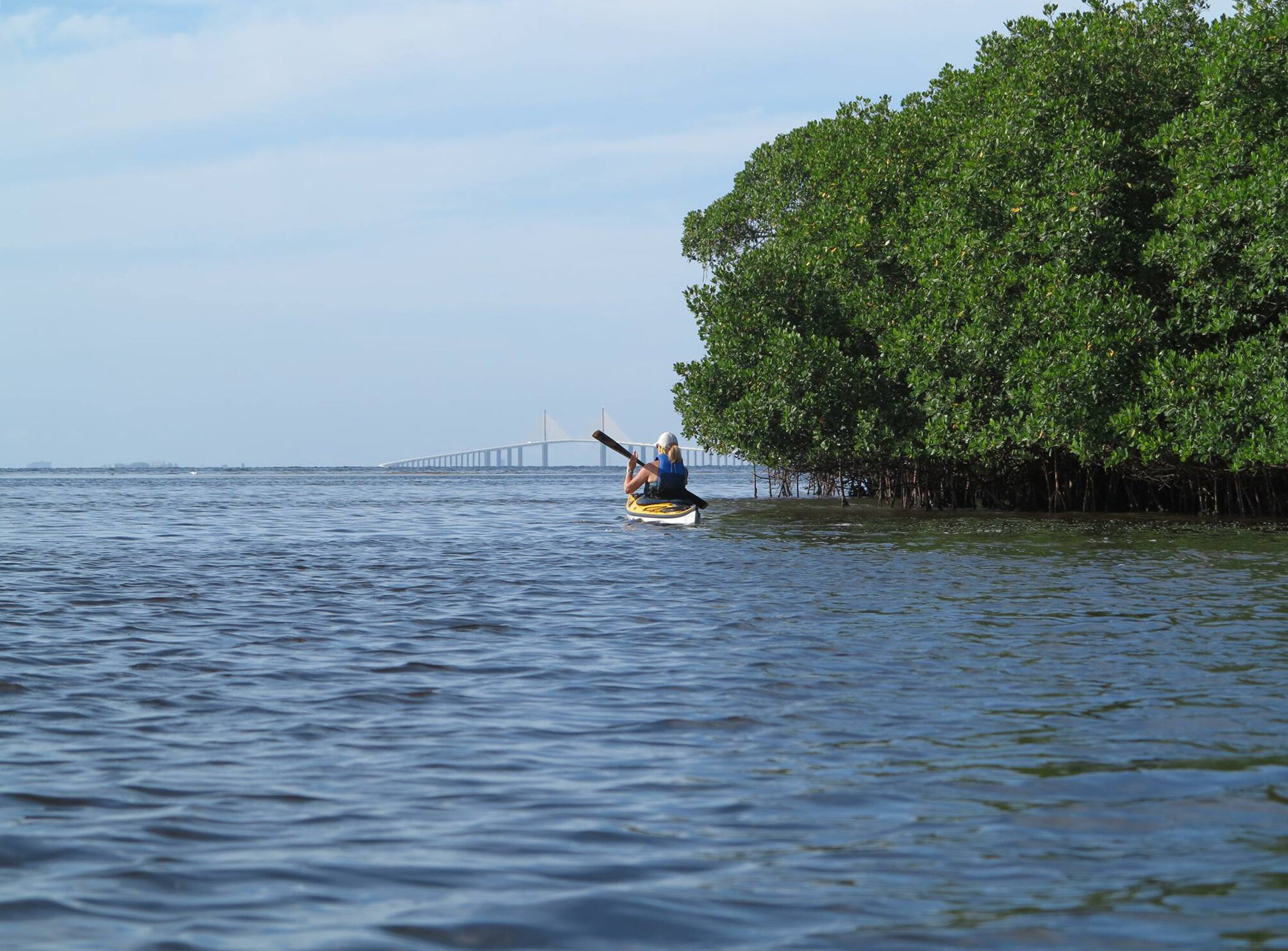
The circumnavigational trail part of this segment starts at Fort De Soto Park, crosses the mouth of Tampa Bay and continues south along the Manatee coastline before ending at Lido Beach.
Crossing Tampa Bay is for experienced paddlers only in calm weather. Strong currents, large ships and waves are factors in the long open water passage. The shortest distance is Fort De Soto to Egmont Key (2 miles), paddle the length of Egmont (2 miles), Passage Key (2 miles) and then to Anna Maria Island (1 mile). In less than optimum weather, we recommend waiting it out or shuttling your boat to Anna Maria.
After arriving at Anna Maria Island, you have two route options, either the Gulf side or Intercoastal Waterway through Anna Maria Sound and Sarasota Bay. Facilities can be found on both routes.
The final coastal stop on this segment is Lido Key, famous for its sun-kissed beaches and southwest Florida lifestyle. After the 15 mile paddle from Bradenton Beach be sure to visit St. Armands Circle for some well deserved upscale dining. Bring a clean shirt!
30 miles of circumnavigational trail
2 county blueways systems
3 state-designated river trails
Florida Cities: Bradenton, Ruskin, Brandon, Sarasota
Contact: Contact our Region D Director or Trailkeeper for more information by clicking here.

Day Paddles and Overnight Camping Trip Maps
Areas
Multiday Trail Maps
Hillsborough Blueways (network of trails throughout Hillsborough County)
Paddle Manatee (75 mile paddle trail system throughout Manatee County)
Environmental Considerations
Crossing Tampa Bay can be hazardous and is recommended for experienced paddlers only
As with most South Florida segments, boat traffic can be heavy, especially on weekends
Emergency Contacts
Police, Fire and Medical Emergencies: 911
Pinellas County Sheriff: 727-582-6200
Manatee County Sheriff: 941-747-3011
Sarasota County Sheriff: 941-861-5800
Florida Fish & Wildlife Commission Hotline: 1-888-404-3922