The Circumnavigational Trail (CT)
“I have made some fun long trips but never had a trail angel support system like the Florida Circumnavigational Saltwater Paddle Trail. Thank you all.” ”
FPTA's founding centered on Florida’s 1,515-mile “CT”— the Florida Circumnavigational Saltwater Paddling Trail. Learn more about the trail, planning, and the paddlers who have completed it.


ABOUT
In 2005, the 1515-mile Circumnavigational Saltwater Paddling Trail (or “CT”) was officially designated by the Florida Legislature as part of the Florida Greenways and Trails System (Title XVIII, Chapter 260 Florida Statutes). Scouting for the trail was completed in the summer of 2007. Another highlight that summer was its designation as a National Recreation Trail by the United States Department of Interior.
Beginning at Big Lagoon State Park near Pensacola, extending around the Florida peninsula and Keys, and ending at Fort Clinch State Park near the Georgia border, the Florida Circumnavigational Saltwater Paddling Trail (commonly referred to as The CT) is a 1,515-mile sea kayaking paradise. The trail includes every Florida coastal habitat type, from barrier island dune systems to salt marsh to mangroves. Numerous historical sites and points of interest are accessible by kayak along with colorful fishing communities and urban centers.
The CT is divided into 26 segments. Each segment is unique, ranging from the remote Big Bend Coast and Everglades/Florida Bay wilderness, to the more urbanized coastlines of Pinellas County and Fort Lauderdale. The trail is utilized by thousands of Florida residents and visitors alike who paddle the trail for a few hours, days, weeks or months. Some hardy souls have paddled the entire trail, and others seek to complete the trail in segments over several years, similar to how hikers often tackle the Florida or Appalachian Trail. The trail is laid out in a counter-clockwise direction, although people can paddle it in either direction. If you plan to shuttle vehicles while paddling along the CT please check Overnight Parking for approved locations.
CT paddlers tend to fall into two categories, "through paddlers" and "section paddlers." "Through paddlers" paddle the CT during one paddling season, usually from two to four months, while "section paddlers" generally paddle a few days at a time and may take several years to complete the entire CT. These paddlers have the advantage of choosing their weather, tides and paddle direction. Regardless of your approach to paddling the CT, you will find it an incredibly enriching way to experience Florida's long coastline, and one that few people ever experience. Remember, it is more about the journey than the destination!
Volunteer Trail Keepers help maintain primitive campsites and 'adopt' stretches of this long-distance trail. We always need more assistance so please consider signing on as a Trail Keeper to help keep this iconic trail a treasure for all paddlers to enjoy. If you want to be part of our fun and dedicated team of Trail Keeper volunteers, click here.


TRIP PLANNER
Maps and Guide
The below maps are intended to be used along with the Florida Circumnavigational Saltwater Paddling Trail Guide (Text Only) and are for general information only. NOAA maps should be used for navigation purposes. Boat ramps, campsites, motels, etc. along the CT may occasionally change, or not be available due to weather damage, change of ownership, etc. It’s best to call ahead to make sure the places on your itinerary are open. For CT Updates (important changes since the last Trail Guide, 9th Edition 2024 was published), check What’s New on the CT. If you notice any situations that have changed from the maps or the Trail Guide, please let us know so we can update the information.
Big Bend Saltwater Paddling Trail Reservation Process
Camping on the Big Bend portion of the trail is managed by the Florida Fish and Wildlife Conservation Commission. Free permits are required for campsites between and including Rock Island and Butler Island, and can be reserved online at https://myfwc.com/recreation/lead/big-bend/paddling-trail/camping-permits/
PLEASE NOTE: "For safety, the FWC will not issue camping permits for canoeists or solo kayak paddlers." on the Big Bend Saltwater Paddling Trail, which is part of the CT.
Everglades National Park Reservation Process
Plan Your Trip: Before booking, you should have a general itinerary, including your desired campsites and trip dates. Be aware that most wilderness sites are only accessible by water (canoe, kayak, or motorboat).
Book Online: Visit the official Recreation.gov website (or use their mobile app/call their reservation line) to check availability and book your sites.
Timing: Campsites are available on a rolling basis, up to 90 days in advance of your start date.
Pay Fees: A non-refundable permit reservation fee of approximately $21 applies, plus an additional $2 per person, per night recreation fee.
Permit Confirmation: Your email confirmation from Recreation.gov serves as your permit; you are no longer required to pick up a physical copy at a visitor center. Have a printed or digital copy with you during your trip.
CT Interactive Map Below (Click on the upper right box to open the full page, scroll in to expand, and click on the icons for additional information) Florida Paddling Trails Association recommends the Alternate (inside) more protected and safer routes in Regions 2, 3, and 4. See the map below.

Legend
Downloadable Maps and KMZs (Click on link to open)
Complete CT Downloadable KMZ (One File, click on link to open)
DEP/OGT Map Site (Click on link to open)
The Florida Circumnavigational Saltwater Paddling Guide (Text Only) Ninth Edition 2024 by The Florida Paddling Trails Association
CT Registry
Once you’ve made up your mind to tackle the CT, and you’ve done the planning, register here in order to be eligible to get into the Hall of Fame upon completion of the CT. Help support our organization by becoming a member here! Upon completing the CT, to be eligible for a free FPTA lifetime membership, and CT completion awards, you must be a member during your CT attempt.
Accessing CT Logbook at Big Lagoon State Park
The CT logbook is located in a lockbox adjacent to the kayak launch at Big Lagoon State Park. The logbook is for historical purposes and all CTer’s are encouraged to make an entry in the logbook. The lock code is 2007. Please replace the lock after signing the logbook (be sure to rotate the lock numbers so the code is not exposed).
Recommended Gear
Boat - 14-1/2’ minimum, preferably a sit inside with 2 watertight compartments. Generally, the longer and narrower the boat, the faster it is, and
less work required. Paddle, spare paddle, spray skirt, cockpit cover, built in compass, painter, emergency repair kit, and a cable lock, if you need
to leave your boat on shore during motel stays or walks to resupply.
Safety/Navigation – PFD, whistle, first aid kit with medications, VHF radio, GPS, Satellite InReach or Spot Messenger, Cell Phone, headlamp, solar
panel and battery pack for charging all electronics, laser flare/standard flares, bilge pump, small compass for PFD, tow rope, paddle float,
multitool, charts, sunscreen
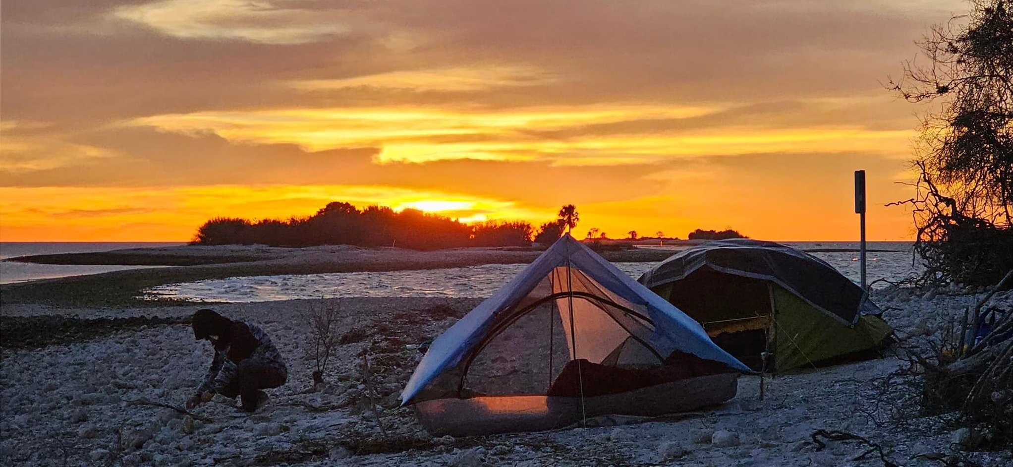
Camp – Lightweight 2-man tent, inflatable mattress & pillow, sleeping bag and sheet, small lightweight tarp, 50’ of parachute cord, camp shoes,
chair, small folding table, sleeping bag, cooking gear, waterproof matches, lighter, camp clothes, headlamp, spare
batteries for all electronics, small fire logs/fire starter, Thermacell, bug repellent, etc.
Clothes - This depends on the weather. Quick dry synthetic shirts and pants, hat, sunglasses, buff, water shoes or neoprene booties, dry camp
shoes, wool socks, lightweight goose down jacket, rain gear
Toiletries - Biodegradable soap, toilet paper, wet wipes, small towel and wash cloth, small lightweight shovel for digging catholes, toothbrush and
toothpaste
Water – Recommend 2L Platypus soft bags, 3L/day. Always bring enough water for a couple of extra days as a precaution.
Food - This depends on your tastes, but realize that you burn a lot of calories in a day when paddling, so always carry plenty of high energy
meals and snacks with you. Always bring enough food for a couple of extra days as a precaution.
Safety Tips
Always wear a PFD, preferably a bright colored one. Check to make sure it is in good condition before departure.
File a float plan. Where you are leaving your vehicle, where you are going, who is with you, what your kayak looks like, and where and what day/time you plan to finish. Instruct the person holding the float plan to notify the Coast Guard or other appropriate agency if you do not return within a reasonable time after your scheduled arrival (taking into account weather, etc.).
Try to paddle with a partner when possible.
Carry a cell phone, GPS and a satellite communicator with SOS capabilities. Make sure all are in working order before starting, and you have a spare set of batteries for everything.
Carry a head lamp in case your paddle trip extends after dark.
Carry a emergency space blanket in case of hypothermia.
Stay hydrated.
Check the weather just before departure.
Do a daily risk assessment before beginning your paddle. Be certain that you have the skills necessary, and the proper equipment, to safely paddle in the CT’s waters.
Take a course on, and be proficient in basic paddle strokes, wet exits, self-rescue and assisted rescues.
Make sure you have a FPTA "IF FOUND - CONTACT" sticker on your paddlecraft in case you get separated from it.
FAQs
How do I get started?
Once you’ve made up your mind to tackle the CT, and you’ve done the planning, fill out and submit the CT Registry form, in order to be eligible to get into the Hall of Fame upon completion of the CT. Registration helps us determine usage, determine maintenance needs at campsites, and to keep records of those who are on the trail. Help support our organization by becoming a member here! Upon completing the CT, to be eligible for a free FPTA lifetime membership, associated awards and invitations to CT Reunions, you must be a member during your CT attempt.
How do I enlist the help of the FPTA Trail Angel network?
First, you must be a FPTA member. If not currently a member, start your membership here. Once you complete the CT, you will be granted a free lifetime membership. Next, go to the CT Registration Page (see FAQ above for link) and register. Then, prior to paddling, go to the CT Coordinator’s page and contact the Director in the Region that you will be paddling in, and apprise her/him of your plans. Please be aware that Trail Angels are volunteers and are not available 24/7, especially if Region Directors are notified at the last minute. Please be considerate with your expectations.
How and where do I sign in to the CT Logbook?
The FPTA maintains a CT Logbook at Big Lagoon State Park. It is intended to be a historical account of CT paddlers. The book is located in a weatherproof box near the CT launch site. CT paddlers can log in anytime they arrive or depart from Big Lagoon State Park. The lock code is 2007. Please replace the lock after signing the logbook (be sure to rotate the lock numbers so the code is not exposed).
How long does it take to paddle the whole trail?
Depending on your skill level, most paddlers take about 90 to 100 paddle days to complete the entire trail. This does not include “zero days” (days when you are unable to paddle due illness, injury, equipment failure, or inclement weather).
What is the most difficult section to paddle?
There is no one section that is the most difficult to paddle, but generally, any open water, passes, and inlets, and shipping channels have more potential for being difficult. Difficulty can depend on a multitude of factors, including but not limited to, wind speed and direction, temperature, fog, rain, tides, tidal current, wave height, etc.
Should I through paddle, or section paddle?
A major determining factor is how much time you have to dedicate to this goal. Depending on your paddling skills and endurance, most through paddlers take between 3 and 4 months. Through paddling takes considerable logistical planning for necessary reservations and resupplying. If you don’t have this amount of time, section paddling is a great alternative, and there is no time limit to complete the trail. Section paddling allows you to choose paddling when the weather, wind speed and direction, season, etc. is to your advantage, but requires planning for shuttles when getting on and off the water. Section planning, however, is no guarantee that you won’t face hardships while on the trail.
Can I paddle in either direction?
Yes, through paddlers can paddle clockwise or counterclockwise. Section paddlers can paddle any section in either direction.
How do I keep track of where I’ve been?
Most CTers keep a simple log, however there are alternative methods, such as, keeping a spreadsheet, keeping your daily tracks on your GPS device or GPS app, and keeping your daily tracks on Google Earth using the Ruler>Path tool to draw in your daily tracks. The latter is a great visual approach to recording your trip, as it automatically includes your daily mileage, and you can add additional information if you wish.
Do I have to turn in documentation after I complete the CT?
No, completing the CT is on the honor system.
Do I have to paddle the Keys both ways?
No, one direction is all that is required.
How do I get into the CT Hall of Fame?
Inductees into the CT Hall of Fame must meet the following criteria:
1. The main source of propulsion must be a paddle.
2. Only sails under one meter squared are allowed.
3. All launch and take out points must connect to form a continuous line around the State (Key Largo to Key West section only has to be completed once). The Trail may be paddled in either direction.
4. All paddlers must practice Leave No Trace principles.
5. All paddlers must register before, or shortly after beginning the CT.
Books About the CT (Click on links to open)
“Florida Circumnavigational Saltwater Paddling Trail” 9th Edition FL 2024 Florida Paddling Trails Association
“Waters Less Traveled” by Doug Alderson
“A Heartfelt Wanderer: The Sunshine Expedition” by Jodi Eller
“L-earn-ing Every Stroke - A 1,500-mile Kayak Adventure Along the Florida Coast” by Jeffrey “Treehouse” Buncie
“Big Bend Saltwater Paddling Guide” by FWC
Other Important Links
2024 Paddling Magazine CT Article
Overnight Parking along the CT
CT Updates (Important changes since the last Trail Guide, 2024 9th Edition was published)
Big Bend Saltwater Paddling Trail Safety Video
Explore Paddler's Trip Reports
Kayak Around Florida (Marc DeLuca & Jim Wendle)
BNC Odysseia (Jeff Buncie)
Go Kayak Florida (Sean Bower)
Warren Johnson
Daniel Alvarez