F: Calusa / Paradise Coast
F: Calusa / Paradise Coast
This region includes the Calusa and Paradise Coast Blueways, extensive networks of paddling trails that extend around coastal islands and shorelines and along interior streams and through mangrove tunnels. Pine Island Sound, Estero Bay and the remote 10,000 Islands are regional highlights. Rivers include the Estero, Caloosahatchee and Hickey's Creek. The 50-mile paddling trail along Fisheating Creek is also a huge attraction. This remote waterway that feeds into Lake Okeechobee is considered one of the best places for stargazing due to the absence of city lights.
12: Pine Island / Estero Bay
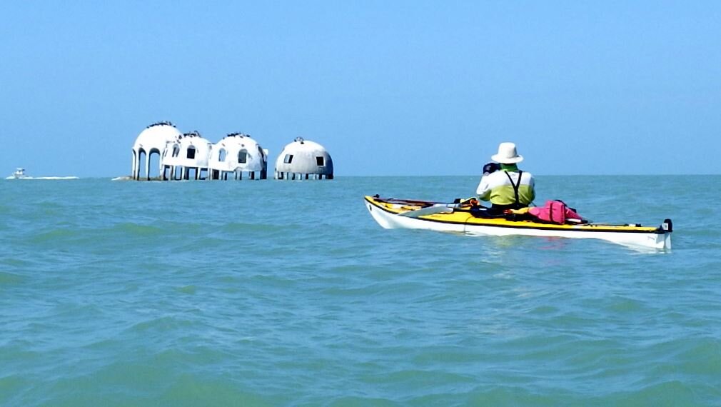
The dominant feature in this segment is The Great Calusa Blueway. This 190-mile network of marked trails in Lee County extends from Pine Island Sound to up the Caloosahatchee River and down to Bonita Springs. The trail also coincides with the circumnavigational trail for several miles.
The northern edge of this segment, Cayo Costa State Park, is accessible only by boat. If you're starting from the mainland but want to spend time at Cayo Costa without paddling, a park service ferry can transport you and your belongings for about $25.
While in the Cayo Costa neighborhood, be sure to stop at Cabbage Key, where there is a popular restaurant and lodge. After enjoying a "cheeseburger in paradise", return to Pine Island to the northern- most town of Bokeelia. Here you'll find Jug Creek Cottages for an overnight stay.
If traveling south on the circumnavigational trail, paddle east of Pine Island through Matlacha Pass Aquatic Preserve and south to the artsy fishing village of Matlacha. Beyond Matlacha lie Picnic Island and the Koreshan State Historic Site.
The romantic sounding Lovers Key / Carl E. Johnson State Park is an ideal place to end this segment. Once the possible hideout of the pirate Black Augustus, this cluster of barrier islands is the perfect place to hike, bike or land your kayak. Unfortunately for most lovers, camping is not allowed in the park.
Two short river trails, Estero River and Hickey Creek, also attract paddlers who seek wild beauty. At the end of the Estero River is Mound Key, once a major village site of the Calusa Indians and now public property. The summit affords a panoramic view of the area. The 50-mile paddling trail along Fisheating Creek is also a huge attraction. This remote waterway that feeds into Lake Okeechobee is considered one of the best places for stargazing due to the absence of city lights.
57.5 miles of Circumnavigational Trail
1 county blueways system
2 state designated river trails
Florida Cities: Fort Myers, Cape Coral, Pine Island, Sanibel, Lehigh Acres, Estero, Bonita Springs
Contact: Contact our Region F Director or Trailkeeper for more information by clicking here.

Day Paddles and Overnight Camping Trip Maps
Areas
Multiday Trail Maps
Great Calusa Blueway (190 miles)
Fisheating Creek (50 miles).
Okeechobee Waterway Trail
Environmental Considerations
Extreme caution should be taken in paddling to and from Cayo Costa and in crossing the various passes. Due to currents and boat traffic, these open water crossings should only be attempted by experienced paddlers in favorable weather conditions along the bay side
Emergency Contacts
Police, Fire and Medical Emergencies: 911
Lee County Sheriff: 239-477-1000
Florida Fish & Wildlife Commission Hotline: 1-888-404-3922
13: Rookery Bay / 10,000 Islands
Welcome to Florida's Ten Thousand Islands and Rookery Bay. It's a watery maze of mangrove keys where Calusa Indians once dug canals and Seminoles and outlaws sought refuge. Men once eked out a living here by hunting alligators and making moonshine. It's the perfect place to escape from it all.
The romantic sounding Lovers Key State Park is an ideal place to begin this segment. You can paddle inside or outside the islands, depending on weather and preference. First stop is Wiggins Pass and Barefoot Beach.
From here, hug the Gulf shoreline heading south to Key Island, just past Naples. Marco Island has the last supermarket on this journey, so stock up for the long haul.
Next comes Cape Romano and Whitehorse Key, in the heart of the Ten Thousand Islands. Paddling the outside route makes for easier navigation.
After Whitehorse Key, you will soon enter Everglades National Park. From Whitehorse, it's 14 miles of islands, sawgrass, mangroves to Everglades City. Camping within the park requires a permit that you must get in person from the visitor's center in Everglades City.
Another popular paddling trail in this segment is the Blackwater/Royal Palm Hammock Trail. The remote trail follows tidally influenced creeks and shallow bays in Collier Seminole State Park. It is marked until it reaches a designated wilderness area, so good maps and a gps unit are necessary.
68 miles of circumnavigational trail
1 state designated interior trail
Florida Cities: Naples, Marco Island, Goodland, Everglades City
Contact: Contact our Region F Director or Trailkeeper for more information by clicking here.

Day Paddles and Overnight Camping Trip Maps
Areas
Multiday Trail Maps
Environmental Considerations
Paddlers have the option of taking the Gulf side of the many islands in this area, making for easier navigation and shorter distances between campsites
In windy or inclement weather paddlers should travel inside the islands through more sheltered bays and waterways
Advanced reservations are recommended for motels and for campsites within Everglades National Park
Navigation in this segment is challenging. NOAA charts and/or a Top Spot map are highly recommended in the Ten Island Islands
Along the Blackwater/Royal Palm Hammock Trail, Palm Bay, Blackwater Bay, and Mud Bay are all potentially shallow depending on tide. Mud Bay may be impassable at low tide.
Emergency Contacts
Police, Fire and Medical Emergencies: 911
Collier County Sheriff: 239-774-4434
Everglades National Park Search and Rescue: 305-247-7272
Florida Fish & Wildlife Commission Hotline: 1-888-404-3922