L: The First Coast
L: The First Coast
From the rich history of North America's oldest European-founded city—St. Augustine—to a civil war fort along the Georgia border, this region boasts unspoiled stretches of public lands and numerous sea islands and winding tidal creeks. Rivers include the lower St. Johns, Nassau and St. Marys.
24: St. Augustine
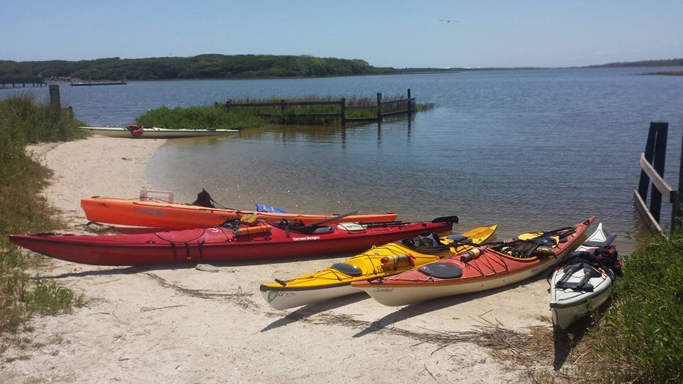
This segment of the circumnavigational trail is steeped in history and blessed with outstanding natural beauty. Here Spain, France, England, the U.S. and Native American tribes wrested for control of Florida through the historic city of St. Augustine. Paddlers can literally touch this history by visiting many sites along the route.
The segment starts at Beverly Beach, just south of Palm Coast, depending on where you put-in. Nearby is Marineland, the world's first oceanarium.
Heading north on the old channel of the Matanzas River just past Mellon Island you can access the Fort Matanzas National Monument. Land near the dock along the east side of the river to tour the visitor's center and take a park service ferry over to the historic fort. Landing near the fort on Rattlesnake Island is not allowed.
Next stop, and a great place to spend the night, is St. Augustine. The Old Town and fort Castillo de San Marcos are favorite areas to explore in the city. Ghost Tours, Ripley's Believe it or Not and many other attractions are within easy walking distance of the St. Augustine Municipal Marina.
The northern end point for this segment is just north of the St. Augustine Inlet.
A portion of the St. Johns River from Satsuma to just south of Green Cove Springs runs through this segment. The river here becomes more than two miles wide, so stay along one shore or the other depending upon prevailing winds.
35.5 miles of Circumnavigational Trail
Florida Cities: St. Augustine, Palm Coast, Palatka
Contact: Contact our Region L Director or Trailkeeper for more information by clicking here.

Day Paddles and Overnight Camping Trip Maps
Areas
Multiday Trail Maps
Environmental Considerations
Boat traffic can be heavy along the Intracoastal Waterway (ICW), especially on weekends and holidays
Paddling the Atlantic is not recommended due to quickly changing conditions, and even in the ICW there is often a strong easterly shore breeze
Emergency Contacts
Police, Fire and Medical Emergencies: 911
St. John's County Sheriff: 800-346-7596
Florida Fish & Wildlife Commission Hotline: 1-888-404-3922
25: Jacksonville
While this segment covers one of the largest urban areas in the state, paddlers will find vast stretches of marsh, islands, beach and coastal forest in prime condition. Helping drive the effort to save environmentally sensitive lands, the City of Jacksonville founded "Preservation Project Jacksonville" in 1999. The project has already acquired over 50,000 acres.
This segment begins at Palm Valley Road, near the Guana Tolomato Matanzas National Estuarine Research Reserve. Heading north, the ICW goes straight and narrow for about nine miles along private land and the Guana River Wildlife Management Area. The west bank is relatively unspoiled and about halfway to the Hwy 202 bridge you pass TPC at Sawgrass, home to the PGA "THE PLAYERS" golf championship.
The ICW widens after the Hwy 202 bridge and becomes more natural looking, with numerous tree islands, tidal creeks and unbroken expanses of marsh. It is here that you'll be in the Northeast Florida Blueways, a scenic network of island preserves, tidal creeks and salt marshes along the ICW from Atlantic Beach to South Jacksonville Beach.
Proceeding north in the ICW, past Tideways and Dutton Islands you'll eventually reach Pablo Island, a small tree-covered spoil area. Sister's Creek Marina in the St. John's River basin is the take-out for this segment.
21 miles of Circumnavigational Trail
Florida Cities: Jacksonville, Atlantic Beach, Middleburg
Contact: Contact our Region L Director or Trailkeeper for more information by clicking here.

Day Paddles and Overnight Camping Trip Maps
Areas
Multiday Trail Maps
Environmental Considerations
Boat traffic can be heavy along the Intracoastal Waterway (ICW), especially on weekends and holidays
Paddling along the high energy East Coast shoreline is not recommended due to safety considerations
There are no inlets in this segment connecting the ICW to the Atlantic with the exception of the St. Johns River. Jetties that extend almost two miles into the Atlantic along the mouth of the St. Johns make this option prohibitive.
Paddlers in the ICW must often contend with a strong easterly shore breeze.
Emergency Contacts
Police, Fire and Medical Emergencies: 911
St. John's County Sheriff: 800-346-7596
Duval County Sheriff: 904-630-0500
Florida Fish & Wildlife Commission Hotline: 1-888-404-3922
26: Timucuan Trails / Fort Clinch
Fort Clinch State Park marks the eastern end of the Florida Circumnavigational Saltwater Paddling Trail. Along this final segment you can experience five state parks: Fort George Island, Little Talbot Island, Big Talbot Island, Amelia Island and Fort Clinch. Besides paddling, opportunities for hiking, swimming, biking and fishing abound.
Sister's Creek Marina on the St. John's River is the put-in for this segment. From the marina go north on Sister's Creek and four miles later head east at the Fort George River. Fort George Island Cultural State Park makes a great lunch stop. From here the trail heads up Simpson Creek for a mile, and then Myrtle Creek to Little Talbot Island State Park.
Day two involves backtracking to Simpson Creek and following it to Nassau Sound, Bird Island and eventually on to Big Talbot Island. Here scenic bluffs make for a great hike and picnic.
A shorter alternate route is to stay on Sister’s Creek (ICW) the entire way to the Nassau River.
Downstream, strong currents exist in Nassau Sound and at the entrance of South Amelia River. Next comes Fernandina Beach and Tiger Island near the Florida / Georgia state line. Fort Clinch State Park lies to the east and is the fitting end of the 1,515 mile saltwater trail.
Several other paddling trails can be found in the area. Most make up the Florida Sea Islands Paddling Trails. An online guide describes 10 saltwater trails and two freshwater-brackish creek trails
Much of the 125-mile St. Mary's River is also included in this segment. Born in the Okefenokee and Pinhook swamps, the tannin waters of the St. Mary's flows in several directions before reaching the Atlantic. Be sure to check water levels before embarking on a paddling journey.
29-30 miles of Circumnavigational Trail
Florida Sea Islands Paddling Trails: 10 saltwater trails and two brackish trails
St. Mary's River (60 mile)
Florida Cities: Fernandia Beach, Callaham
Contact: Contact our Region L Director or Trailkeeper for more information by clicking here.

Day Paddles and Overnight Camping Trip Maps
Areas
Multiday Trail Maps
St Mary's River Trail (90.6 miles)
Environmental Considerations
Paddlers need to be watchful of tides and currents, especially near river mouths
The Intracoastal Waterway can be busy on weekends and holidays
The Atlantic side of this segment is considered dangerous and recommended for expert paddlers only
For those paddling the Atlantic, jetties along the mouth of the St. John's River extend almost two miles into the ocean
Emergency Contacts
Police, Fire and Medical Emergencies: 911
Duval County Sheriff: 904-630-0500
Nassau County Sheriff: 904-225-5174
Florida Fish & Wildlife Commission Hotline: 1-888-404-3922